Groningen
- Details
- Category: 12 provinces
Groningen is the northeasternmost province of the Netherlands. In the east it borders the German state of Niedersachsen (districts of Leer and Emsland), in the south Drenthe, in the west Friesland and in the north the Wadden Sea. The capital of the province is the city of Groningen.
Geography
 Land use in Groningen is mainly agricultural; it has a large natural gas field near Slochteren. but, Groningen has many historical monuments and many old buildings in almost every village.
History
Originally a part of Frisia, Groningen became a part of the Frankish Empire around 785. Charlemagne assigned the Christianization of this new possession to Ludger. In the 11th century, the city of Groningen was a village in Drenthe that belonged to the Bishopric of Utrecht, while most of the province was in the diocese of Münster. During the Middle Ages, central control was remote, and the city of Groningen acted as a city state, exerting a dominating influence on the surrounding Ommelanden. Around 1500, Maximilian I, Holy Roman Emperor gave Groningen and Friesland to Albert, Duke of Saxony, who could however not establish permanent control. In 1514/15 Groningen came to the Duchy of Guelders, and in 1536 to the Habsburg Netherlands. In 1594, Groningen was conquered by the United Netherlands, to which it belonged henceforth.
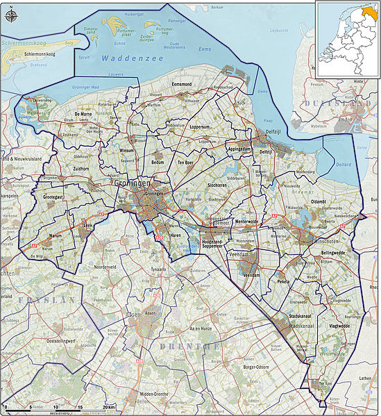
Municipalities
Appingedam
Bedum
Bellingwedde
De Marne
Delfzijl
Eemsmond
Groningen
Grootegast
Haren
Hoogezand-Sappemeer
Leek
Loppersum
Marum
Menterwolde
Oldambt
Pekela
Slochteren
Stadskanaal
Ten Boer
Veendam
Vlagtwedde
Winsum
Zuidhorn
Gazetteer for Goningen on Google Maps
