-
Amsterdam Canals
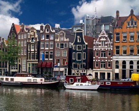
Amsterdam, capital of the Netherlands, has been called the "Venice of the North" for its more than one hundred kilometres of canals, about 90 islands and 1,500 bridges Read More -
Anne Frank House
The Anne Frank House located on the Prinsengracht canal in Amsterdam, the Netherlands, is a museum dedicated to Jewish wartime diarist Anne Frank, who hid from Nazi persecution with her family and four other people in hidden rooms at the rear of the building. Read More -
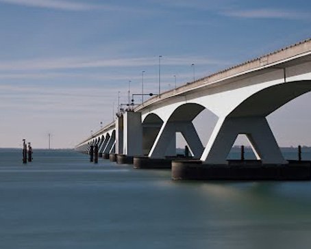
Deltaworks
Flood control is an important issue for the Netherlands, as about two thirds of its area is vulnerable to flooding, while the country is among the most densely populated on Earth. Natural sand dunes and man-made dikes, dams and floodgates provide defense against storm surges from the sea. Read More -
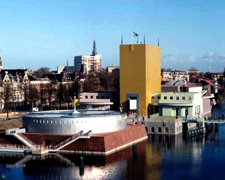
Rotterdam Architecture
Rotterdam is the second-largest city in the Netherlands and one of the largest ports in the world. Rotterdam is also famous for its Kubuswoningen or cube houses built by architect Piet Blom in 1984. In addition to that there are many international well known architects based in Rotterdam like O.M.A (Rem Koolhaas), MVRDV, Neutelings & Riedijk and Erick van Egeraat to name a few. Read More -
Google Maps - Aviation waypoints
A waypoint is a reference point in physical space used for purposes of navigation. Waypoints are sets of coordinates that identify a point in physical space. Coordinates used can vary depending on the application. Read More
-
 Flevoland is a province of the Netherlands. Located in the centre of the country, at the location of the former Zuiderzee, the province was established on January 1, 1986; the twelfth province of the country, with Lelystad as its capital. The province has approximately 394,758 inhabitants (2011) and consists of 6 municipalities.Read More
Flevoland
-
 Gelderland is a province of the Netherlands, located in the central eastern part of the country. Historically, the province (area) dates from states of the Holy Roman Empire and takes its name from the nearby German city of Geldern.Read More
Gelderland
-
 Groningen is the northeasternmost province of the Netherlands. In the east it borders the German state of Niedersachsen (districts of Leer and Emsland), in the south Drenthe, in the west Friesland and in the north the Wadden Sea. The capital of the province is the city of Groningen.Read More
Groningen
-
 Limburg is the southernmost of the twelve provinces of the Netherlands. It is located in the southeastern part of the country and is bordered by the Dutch provinces of Gelderland to the north and North Brabant to the north and northwest, Germany to the east and Belgium to the south and part of the west. Its capital is Maastricht.Read More
Limburg
-
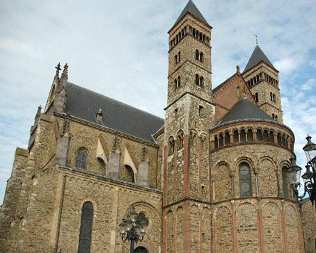
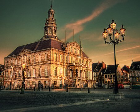 Maastricht is a city in the Netherlands. It is located in the southern part of the Dutch province of Limburg, of which it is the capital.Read More
Maastricht
-
 North Brabant (Dutch: Noord-Brabant is a province of the Netherlands, located in the south of the country, bordered by Belgium's Antwerp and Limburg provinces in the south, the Meuse River (Maas) in the north, and Limburg in the east and Zeeland in the west.Read More
North Brabant
-
 North Holland is a province situated on the North Sea in the northwest of the Netherlands. The provincial capital is Haarlem and its largest city is Amsterdam.Read More
North Holland
-
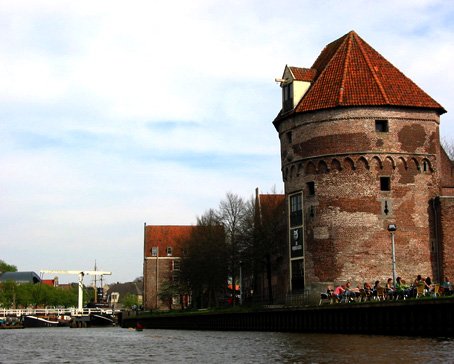 Overijssel is a province[1] of the Netherlands in the central-eastern part of the country. The province's name means "Lands across the river Issel", from the perspective of southern Europe. The capital city of Overijssel is Zwolle and the largest city is Enschede. The province has a population of 1,113,529 inhabitants.Read More
Overijssel
-
 South Holland is a province situated on the North Sea in the western part of the Netherlands. The provincial capital is The Hague and its largest city is Rotterdam.Read More
South Holland

North Sea Canal
- Details
- Category: Amsterdam
The North Sea Canal (Dutch: Noordzeekanaal) is a Dutch ship canal from Amsterdam to the North Sea at IJmuiden, constructed between 1865 and 1876 to enable seafaring vessels to reach the port of Amsterdam.
 This man-made channel terminates at Amsterdam in the closed-off IJ Bay, which in turn connects to the Amsterdam-Rhine Canal.
The drainage of the canal to the North Sea is done through the Spui Locks at IJmuiden, augmented by the largest pumping station in Europe. This system is vital to the groundwater management of the western Netherlands.
History
To improve the connection between the harbour of Amsterdam and the North Sea, the North Holland Canal was built in 1824. But this long and narrow canal was quickly inadequate to handle the growing boat traffic. A few decades later it was decided to dig a new canal at the narrowest point in Holland and thereby providing the shortest route to the sea.
Digging began on 8 March 1865, at the dunes of Breesaap and lasted until 1876. Since no Dutch company was willing to take on this task, the project was awarded to an English contractor.
The North Sea Canal was built by digging a channel through the old IJ Bay and lining it with dikes, after which the remaining portions of the IJ Bay were reclaimed and turned into polders. From this bay to the sea, a new canal was dug through the dunes at Velsen. To accommodate drainage of and shipping on the tributaries of the IJ, such as the Spaarne, the Zaan, and the Nauerna Canal, nine auxiliary canals needed to be dug as well (Side Canals "A" to "I").
 A small set of locks (Zuidersluis) were built at the mouth in 1876 where the new town of IJmuiden (Dutch for "IJ Mouth") formed. In 1896 the Middle Locks (Middensluis) were built, followed by the North Locks (Noordersluis) in 1929, which were Europe's largest locks at that time.
Historic map of Velsen showing the western portion of the IJ and the planned route of the canal.
At the eastern end of the canal, east of Amsterdam, the IJ Bay was open to the Zuiderzee until 1872 when the Orange Locks (Oranjesluizen) were built. With the completion of these locks the North Sea Canal and IJ Bay were no longer open to the sea and a specific water level could be maintained.
The canal was dug using manual labour. The workers lived in horrid conditions, being housed in huts built from twigs, driftwood, sod, and straw, where disease, fights, and alcohol abuse were rampant.
On 1 November 1876, the North Sea Canal was officially opened by King William III of the Netherlands. Over the years the canal has been widened and deepened several times.
Side canals
The North Sea Canal and the IJ have 10 side canals (in Dutch: Zijkanaal), which connect to rivers and other canals which used to flow into the former IJ Bay before its reclamation.
Satellite photo
* Zijkanaal A - connects the harbour of Beverwijk to the North Sea Canal, also an inundation canal of the Stelling van Amsterdam.
* Zijkanaal B - connected Spaarndam to the North Sea Canal, but was cut off from it by the construction of the A9 motorway in the 1960s. It is now used for canoeing and mooring of houseboats.
* Zijkanaal C - connects the Spaarne river at Spaarndam to the North Sea Canal at Buitenhuizen, and also functions as the main drainage canal of the Rijnland water board. The A9 motorway has an operable bridge over this side canal.
* Zijkanaal D - connects the Nauerna Canal to the North Sea Canal.
* Zijkanaal E - a very short canal connecting the south end of Westzaan to the North Sea Canal.
* Zijkanaal F - connected Halfweg to the North Sea Canal, but is now mostly backfilled. A small portion remains and is used as a drainage canal.
* Zijkanaal G - connects Zaandam and the Zaan River to the North Sea Canal.
* Zijkanaal H - connects the Barndegat to the North Sea Canal.
* Zijkanaal I - connects the East Zaan Overtoom to the IJ Bay.
* Zijkanaal K - connects the harbour of Nieuwendam to the IJ Bay.
Latest articles
- Accommodatie Eurovisie Songfestival 2020 - Rotterdam
- Vermeer - famous Dutch painter from Delft
- Delft - Oude Kerk - Old Church
- Delft
- Enkhuizen - Havenweg - streetview - Google Maps
- Alkmaar - cheese market - Waagplein - streetview - Google Maps
- Hoorn - city center - Roode Steen - streetview - Google Maps
- Veere - Townhall - streetview - Google Maps
- Middelburg - Townhall - streetview - Google Maps
- Vlissingen - Smallekade - streetview - Google Maps
- Zierikzee- streetview - Google Maps
- Oosterschelde- streetview - Google Maps
- Haringvlietdam - Haringvlietsluis - streetview - Google Maps
- Hollands Diep - streetview - Google Maps
- Moerdijk bridges - streetview - Google Maps
- Harlingen - streetview - Google Maps
- Stavoren - streetview
- Dokkum - streetview
- Giethoorn - streetview
- Claire Morgan The Sound of Silence - Noord Brabants Museum
Visitors for Visitholland
We have 121 guests and no members online