-
Amsterdam Canals
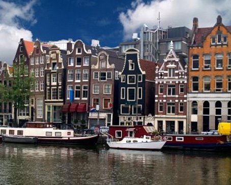
Amsterdam, capital of the Netherlands, has been called the "Venice of the North" for its more than one hundred kilometres of canals, about 90 islands and 1,500 bridges Read More -
Anne Frank House
The Anne Frank House located on the Prinsengracht canal in Amsterdam, the Netherlands, is a museum dedicated to Jewish wartime diarist Anne Frank, who hid from Nazi persecution with her family and four other people in hidden rooms at the rear of the building. Read More -
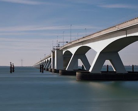
Deltaworks
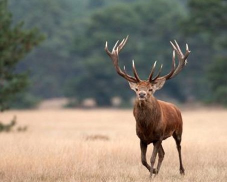
Flood control is an important issue for the Netherlands, as about two thirds of its area is vulnerable to flooding, while the country is among the most densely populated on Earth. Natural sand dunes and man-made dikes, dams and floodgates provide defense against storm surges from the sea. Read More -
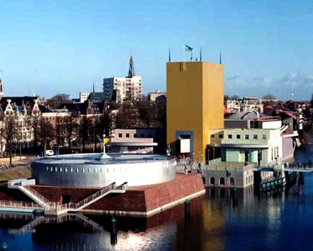
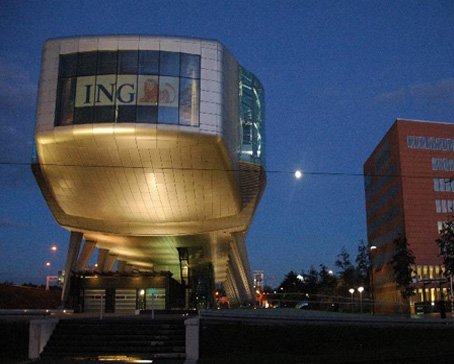
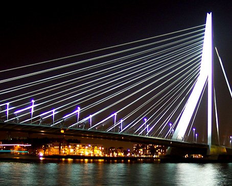
Rotterdam Architecture
Rotterdam is the second-largest city in the Netherlands and one of the largest ports in the world. Rotterdam is also famous for its Kubuswoningen or cube houses built by architect Piet Blom in 1984. In addition to that there are many international well known architects based in Rotterdam like O.M.A (Rem Koolhaas), MVRDV, Neutelings & Riedijk and Erick van Egeraat to name a few. Read More -
Google Maps - Aviation waypoints
A waypoint is a reference point in physical space used for purposes of navigation. Waypoints are sets of coordinates that identify a point in physical space. Coordinates used can vary depending on the application. Read More
-
 Flevoland is a province of the Netherlands. Located in the centre of the country, at the location of the former Zuiderzee, the province was established on January 1, 1986; the twelfth province of the country, with Lelystad as its capital. The province has approximately 394,758 inhabitants (2011) and consists of 6 municipalities.Read More
Flevoland
-
 Gelderland is a province of the Netherlands, located in the central eastern part of the country. Historically, the province (area) dates from states of the Holy Roman Empire and takes its name from the nearby German city of Geldern.Read More
Gelderland
-
 Groningen is the northeasternmost province of the Netherlands. In the east it borders the German state of Niedersachsen (districts of Leer and Emsland), in the south Drenthe, in the west Friesland and in the north the Wadden Sea. The capital of the province is the city of Groningen.Read More
Groningen
-
 Limburg is the southernmost of the twelve provinces of the Netherlands. It is located in the southeastern part of the country and is bordered by the Dutch provinces of Gelderland to the north and North Brabant to the north and northwest, Germany to the east and Belgium to the south and part of the west. Its capital is Maastricht.Read More
Limburg
-
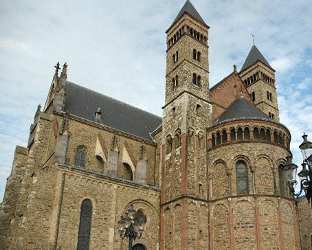
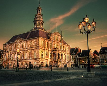 Maastricht is a city in the Netherlands. It is located in the southern part of the Dutch province of Limburg, of which it is the capital.Read More
Maastricht
-
 North Brabant (Dutch: Noord-Brabant is a province of the Netherlands, located in the south of the country, bordered by Belgium's Antwerp and Limburg provinces in the south, the Meuse River (Maas) in the north, and Limburg in the east and Zeeland in the west.Read More
North Brabant
-
 North Holland is a province situated on the North Sea in the northwest of the Netherlands. The provincial capital is Haarlem and its largest city is Amsterdam.Read More
North Holland
-
 Overijssel is a province[1] of the Netherlands in the central-eastern part of the country. The province's name means "Lands across the river Issel", from the perspective of southern Europe. The capital city of Overijssel is Zwolle and the largest city is Enschede. The province has a population of 1,113,529 inhabitants.Read More
Overijssel
-
 South Holland is a province situated on the North Sea in the western part of the Netherlands. The provincial capital is The Hague and its largest city is Rotterdam.Read More
South Holland

Hoorn - city center - Roode Steen - streetview - Google Maps
- Details
- Category: Streetview Visitholland
Hoorn is a municipality and a town in the Netherlands, in the province of North Holland. It is located on the Markermeer, 35 kilometres north of Amsterdam, and acquired city rights in 1357. Hoorn had a population of 71,888 in 2014. The area of the municipality is 53.25 km2 (20.56 sq mi) of which 33.00 km2 (12.74 sq mi) consists of water, mainly the Markermeer. The municipality consists of the following villages and/or districts: Blokker, Hoorn, Zwaag, and parts of Bangert and De Hulk.
Cape Horn, the most southerly point of the Americas, was named after the town by Willem Schouten, who rounded it in 1616. The Hoorn Islands of the Oceanian nation of Wallis and Futuna are also named after this city.
History
Founded in 716, Hoorn rapidly grew to become a major harbour town. During Holland's 'Golden Age' (or 'Golden Century'), Hoorn was an important home base for the Dutch East India Company (VOC) and a very prosperous centre of trade. The Hoorn fleet plied the seven seas and returned laden with precious commodities. Exotic spices such as pepper, nutmeg, cloves, and mace were sold at vast profits. With their skill in trade and seafaring, sons of Hoorn established the town's name far and wide. Jan Pieterszoon Coen (1587–1629) is famous for his violent raids in Dutch Indies (now Indonesia), where he "founded" the city of Batavia in 1619 (now Jakarta). He has a big statue on the Rode Steen square in the center of Hoorn.
In 1618 Willem Bontekoe (1587–1657) undertook his first and only voyage for the VOC. His story of his travel and hardship found its way into the history books when he published his adventures in 1646 under the title Journael ofte gedenckwaerdige beschrijvinge van de Oost-Indische reyse van Willem Ysbrantsz. Bontekoe van Hoorn, begrijpende veel wonderlijcke en gevaerlijcke saecken hem daer in wedervaren ('Journal, or memorable description, of the East-Indian voyage of Willem Ysbrantz. Bontekoe of Hoorn, comprising many wondrous and dangerous things experienced by him'). In 1616, the explorer Willem Corneliszoon Schouten braved furious storms as he rounded the southernmost tip of South America. He named it Kaap Hoorn (Cape Horn) in honour of his home town.
Hoorn's fortunes declined somewhat in the eighteenth century. The prosperous trading port became little more than a sleepy fishing village on the Zuiderzee. Following the Napoleonic occupation, there was a period during which the town gradually turned its back on the sea. It developed to become the market for the entire West Frisian agricultural region. Stallholders and shopkeepers devoted themselves to trading in dairy produce and seeds. When the railway and metalled roads came to Hoorn in the late nineteenth century, the town rapidly took its rightful place as a conveniently located and readily accessible centre in the network of towns and villages which make up the province of Noord-Holland. In 1932, the Afsluitdijk, or Great Enclosing Dyke, was completed, and Hoorn was no longer a seaport.
The years after the Second World War saw a period of renewed growth. At the centre of a flourishing horticultural region, Hoorn developed an extremely varied economy. During the 1960s, Hoorn was designated an 'overflow' city to relieve pressure on the overcrowded Randstad region. Thousands of people swapped their cramped little apartments in Amsterdam for a family house with garden in one of Hoorn's modern new developments.
On 26 March 2007, Hoorn celebrated 650 years as a city: in 1357 Hoorn was awarded city rights by the Count of Holland after a lump sum payment of 1500 schilden to the Count.
Hotels in Hoorn
Latest articles
- Accommodatie Eurovisie Songfestival 2020 - Rotterdam
- Vermeer - famous Dutch painter from Delft
- Delft - Oude Kerk - Old Church
- Delft
- Enkhuizen - Havenweg - streetview - Google Maps
- Alkmaar - cheese market - Waagplein - streetview - Google Maps
- Hoorn - city center - Roode Steen - streetview - Google Maps
- Veere - Townhall - streetview - Google Maps
- Middelburg - Townhall - streetview - Google Maps
- Vlissingen - Smallekade - streetview - Google Maps
- Zierikzee- streetview - Google Maps
- Oosterschelde- streetview - Google Maps
- Haringvlietdam - Haringvlietsluis - streetview - Google Maps
- Hollands Diep - streetview - Google Maps
- Moerdijk bridges - streetview - Google Maps
- Harlingen - streetview - Google Maps
- Stavoren - streetview
- Dokkum - streetview
- Giethoorn - streetview
- Claire Morgan The Sound of Silence - Noord Brabants Museum
Visitors for Visitholland
We have 105 guests and no members online