-
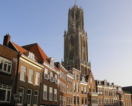
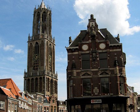
Amsterdam Canals
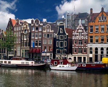
Amsterdam, capital of the Netherlands, has been called the "Venice of the North" for its more than one hundred kilometres of canals, about 90 islands and 1,500 bridges Read More -
Anne Frank House
The Anne Frank House located on the Prinsengracht canal in Amsterdam, the Netherlands, is a museum dedicated to Jewish wartime diarist Anne Frank, who hid from Nazi persecution with her family and four other people in hidden rooms at the rear of the building. Read More -
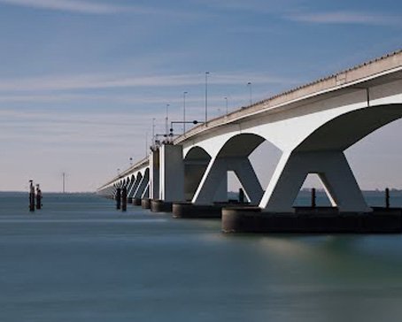
Deltaworks
Flood control is an important issue for the Netherlands, as about two thirds of its area is vulnerable to flooding, while the country is among the most densely populated on Earth. Natural sand dunes and man-made dikes, dams and floodgates provide defense against storm surges from the sea. Read More -
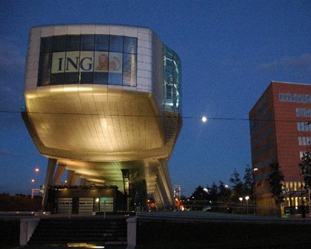
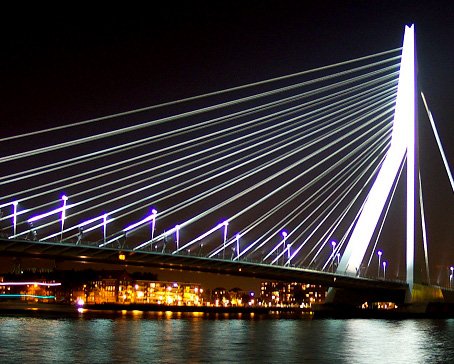
Rotterdam Architecture
Rotterdam is the second-largest city in the Netherlands and one of the largest ports in the world. Rotterdam is also famous for its Kubuswoningen or cube houses built by architect Piet Blom in 1984. In addition to that there are many international well known architects based in Rotterdam like O.M.A (Rem Koolhaas), MVRDV, Neutelings & Riedijk and Erick van Egeraat to name a few. Read More -
Google Maps - Aviation waypoints
A waypoint is a reference point in physical space used for purposes of navigation. Waypoints are sets of coordinates that identify a point in physical space. Coordinates used can vary depending on the application. Read More
-
 Flevoland is a province of the Netherlands. Located in the centre of the country, at the location of the former Zuiderzee, the province was established on January 1, 1986; the twelfth province of the country, with Lelystad as its capital. The province has approximately 394,758 inhabitants (2011) and consists of 6 municipalities.Read More
Flevoland
-
 Gelderland is a province of the Netherlands, located in the central eastern part of the country. Historically, the province (area) dates from states of the Holy Roman Empire and takes its name from the nearby German city of Geldern.Read More
Gelderland
-
 Groningen is the northeasternmost province of the Netherlands. In the east it borders the German state of Niedersachsen (districts of Leer and Emsland), in the south Drenthe, in the west Friesland and in the north the Wadden Sea. The capital of the province is the city of Groningen.Read More
Groningen
-
 Limburg is the southernmost of the twelve provinces of the Netherlands. It is located in the southeastern part of the country and is bordered by the Dutch provinces of Gelderland to the north and North Brabant to the north and northwest, Germany to the east and Belgium to the south and part of the west. Its capital is Maastricht.Read More
Limburg
-
 Maastricht is a city in the Netherlands. It is located in the southern part of the Dutch province of Limburg, of which it is the capital.Read More
Maastricht
-
 North Brabant (Dutch: Noord-Brabant is a province of the Netherlands, located in the south of the country, bordered by Belgium's Antwerp and Limburg provinces in the south, the Meuse River (Maas) in the north, and Limburg in the east and Zeeland in the west.Read More
North Brabant
-
 North Holland is a province situated on the North Sea in the northwest of the Netherlands. The provincial capital is Haarlem and its largest city is Amsterdam.Read More
North Holland
-
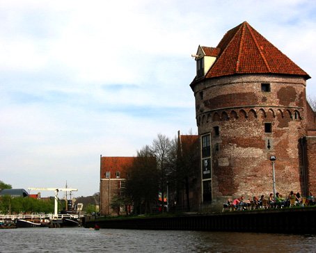 Overijssel is a province[1] of the Netherlands in the central-eastern part of the country. The province's name means "Lands across the river Issel", from the perspective of southern Europe. The capital city of Overijssel is Zwolle and the largest city is Enschede. The province has a population of 1,113,529 inhabitants.Read More
Overijssel
-
 South Holland is a province situated on the North Sea in the western part of the Netherlands. The provincial capital is The Hague and its largest city is Rotterdam.Read More
South Holland

Natural Landscapes in Holland
- Details
- Category: Uncategorised
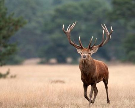
The Veluwe is a forest-rich ridge of hills (1100 km²) in the province of Gelderland in the Netherlands. The Veluwe features many different landscapes including woodland, heath, some small lakes and Europe's largest sand drifts.
The Veluwe is the largest push moraine complex in the Netherlands, stretching 60 km from north to south, and reaching heights of up to 110 metres. The Veluwe was formed by the Saalian glacial during the Pleistocene epoch, some 200,000 years ago. Glaciers some 200 metres thick[citation needed] pushed the sand deposits in the Rhine and Maas Delta sideways, creating the hills which now form most of the Veluwe. Because the hills are made of sand, rain water disappears rapidly, and then it flows at a depth of tens of metres to the edges where it reaches the surface again.
Originally the Veluwe was surrounded by a string of swamps, heavily populated with game such as deer and wild boars because these areas offered rich vegetation to feed on. Since the 1990s many plans are underway, or have already been implemented, to restore these wetlands by blocking the drainage systems built by farmers during the last 150 years. This results in very dry heathland changing into wetland within a span of just a few hundred metres. The Wisselse Veen near the village of Epe, on the North East Veluwe, offers a good example of this.
Flora and fauna
There are both coniferous and deciduous forests on the Veluwe, and some 500 different plant species can be found. The region is also home to many different species of animals, such as wild boars, several species of deer, several species of snakes (including the common viper), Pine Martens, foxes, and badgers. Furthermore, the bird raven was successfully reintroduced, and the exotic Reeves's muntjac and mouflon can sometimes be seen. In all, the Veluwe is among the best places in the Netherlands to see wildlife.
Developments
Parts of the Veluwe that have been separated from each other by roads, towns and farmland are being reconnected by returning farmland to nature and creating wildlife crossings over highways. In 2012, nine of these overpasses had been built, each one about 50 metres wide and covered with sand and vegetation to encourage animals to use it. [1] Wildlife corridors connecting the Veluwe to other wildlife areas such as the Oostvaardersplassen in the Netherlands and the Klever Reichswald in Germany are being developed. It is hoped that by doing so the genetic diversity of the wildlife population will increase.
Tourism and recreation
The Veluwe is a popular tourist destination, especially for Dutch people wanting to go on a short vacation in their own country. Campsites and bungalow parks are the preferred place to stay for most visitors. There are more than 500 of these sites, more than in all of Switzerland. Most of these are located on the outskirts of the natural area. One of the bungalow parks located in a more sensitive natural area was removed around 2004, and there are other candidates. In order to turn the entire Veluwe into one large National Park, and meet the IUCN standards for a National Park (a IUCN-category two area), such moves are necessary. Removing remaining fences, as around De Hoge Veluwe and some other areas, is also essential. Around 2006, an old industrial zone near the village of Renkum was cleared away because it blocked a valley that was important for the migration of wildlife. A military complex near Nunspeet was removed instead of being redeveloped as a business area.
Besides the natural beauty of the area, other tourist attractions include four zoos, over 50 museums including the famous Kröller-Müller art museum, and the royal palace Het Loo at Apeldoorn. The National Sports Centre Papendal, a large sports complex and Olympic Games training facility is located in the south of the Veluwe near Arnhem.
Etymology
Veluwe derives from Germanic *falwa (pale) in the sense of "infertile" or "unproductive". The name corresponds to "fallow lands" in English and probably was used in opposition to the fertile "good lands" of the Betuwe to the south.
Towns and Cities
There are 21 municipalities in the Veluwe region: Apeldoorn, Arnhem, Barneveld, Brummen, Ede, Elburg, Epe, Ermelo, Harderwijk, Hattem, Heerde, Nijkerk, Nunspeet, Oldebroek, Putten, Renkum, Rheden, Rozendaal, Scherpenzeel, Voorst and Wageningen.
Latest articles
- Accommodatie Eurovisie Songfestival 2020 - Rotterdam
- Vermeer - famous Dutch painter from Delft
- Delft - Oude Kerk - Old Church
- Delft
- Enkhuizen - Havenweg - streetview - Google Maps
- Alkmaar - cheese market - Waagplein - streetview - Google Maps
- Hoorn - city center - Roode Steen - streetview - Google Maps
- Veere - Townhall - streetview - Google Maps
- Middelburg - Townhall - streetview - Google Maps
- Vlissingen - Smallekade - streetview - Google Maps
- Zierikzee- streetview - Google Maps
- Oosterschelde- streetview - Google Maps
- Haringvlietdam - Haringvlietsluis - streetview - Google Maps
- Hollands Diep - streetview - Google Maps
- Moerdijk bridges - streetview - Google Maps
- Harlingen - streetview - Google Maps
- Stavoren - streetview
- Dokkum - streetview
- Giethoorn - streetview
- Claire Morgan The Sound of Silence - Noord Brabants Museum
Visitors for Visitholland
We have 56 guests and no members online