-
Amsterdam Canals
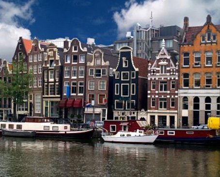
Amsterdam, capital of the Netherlands, has been called the "Venice of the North" for its more than one hundred kilometres of canals, about 90 islands and 1,500 bridges Read More -
Anne Frank House
The Anne Frank House located on the Prinsengracht canal in Amsterdam, the Netherlands, is a museum dedicated to Jewish wartime diarist Anne Frank, who hid from Nazi persecution with her family and four other people in hidden rooms at the rear of the building. Read More -
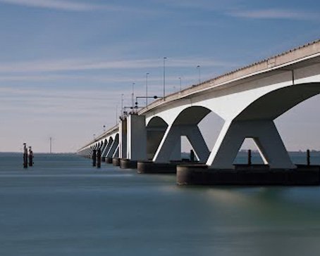
Deltaworks
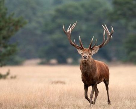
Flood control is an important issue for the Netherlands, as about two thirds of its area is vulnerable to flooding, while the country is among the most densely populated on Earth. Natural sand dunes and man-made dikes, dams and floodgates provide defense against storm surges from the sea. Read More -
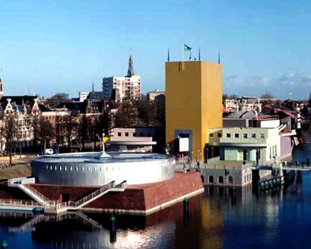
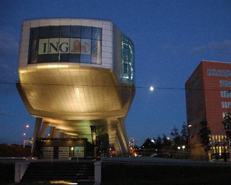
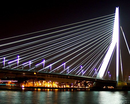
Rotterdam Architecture
Rotterdam is the second-largest city in the Netherlands and one of the largest ports in the world. Rotterdam is also famous for its Kubuswoningen or cube houses built by architect Piet Blom in 1984. In addition to that there are many international well known architects based in Rotterdam like O.M.A (Rem Koolhaas), MVRDV, Neutelings & Riedijk and Erick van Egeraat to name a few. Read More -
Google Maps - Aviation waypoints
A waypoint is a reference point in physical space used for purposes of navigation. Waypoints are sets of coordinates that identify a point in physical space. Coordinates used can vary depending on the application. Read More
-
 Flevoland is a province of the Netherlands. Located in the centre of the country, at the location of the former Zuiderzee, the province was established on January 1, 1986; the twelfth province of the country, with Lelystad as its capital. The province has approximately 394,758 inhabitants (2011) and consists of 6 municipalities.Read More
Flevoland
-
 Gelderland is a province of the Netherlands, located in the central eastern part of the country. Historically, the province (area) dates from states of the Holy Roman Empire and takes its name from the nearby German city of Geldern.Read More
Gelderland
-
 Groningen is the northeasternmost province of the Netherlands. In the east it borders the German state of Niedersachsen (districts of Leer and Emsland), in the south Drenthe, in the west Friesland and in the north the Wadden Sea. The capital of the province is the city of Groningen.Read More
Groningen
-
 Limburg is the southernmost of the twelve provinces of the Netherlands. It is located in the southeastern part of the country and is bordered by the Dutch provinces of Gelderland to the north and North Brabant to the north and northwest, Germany to the east and Belgium to the south and part of the west. Its capital is Maastricht.Read More
Limburg
-
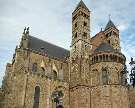
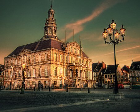 Maastricht is a city in the Netherlands. It is located in the southern part of the Dutch province of Limburg, of which it is the capital.Read More
Maastricht
-
 North Brabant (Dutch: Noord-Brabant is a province of the Netherlands, located in the south of the country, bordered by Belgium's Antwerp and Limburg provinces in the south, the Meuse River (Maas) in the north, and Limburg in the east and Zeeland in the west.Read More
North Brabant
-
 North Holland is a province situated on the North Sea in the northwest of the Netherlands. The provincial capital is Haarlem and its largest city is Amsterdam.Read More
North Holland
-
 Overijssel is a province[1] of the Netherlands in the central-eastern part of the country. The province's name means "Lands across the river Issel", from the perspective of southern Europe. The capital city of Overijssel is Zwolle and the largest city is Enschede. The province has a population of 1,113,529 inhabitants.Read More
Overijssel
-
 South Holland is a province situated on the North Sea in the western part of the Netherlands. The provincial capital is The Hague and its largest city is Rotterdam.Read More
South Holland

South Holland
- Details
- Category: 12 provinces
South Holland is a province situated on the North Sea in the western part of the Netherlands. The provincial capital is The Hague and its largest city is Rotterdam.
South Holland is one of the most densely populated and industrialised areas in the world. With a population of 3,502,595 (30 November 2009) and an area of 3,403 km², the province has the highest population density in the Netherlands.
History
For more on the history of South Holland in the context of Dutch history, see the article on the "History of the Netherlands". The history of this province can also be found in the articles on its constituent elements (e.g. Rotterdam, the Hague, etc.) The information here pertains just to South Holland itself.
Before 1795
For most of its history, the modern-day province of South Holland was an integral part of Holland.
From the 9th century to the 16th century, Holland was a county of the Holy Roman Empire, and was ruled by the counts of Holland. Some of the counts were powerful magnates who also ruled many other territories, culminating in a period of rule by the House of Habsburg which was terminated by the Dutch Revolt.
From the 16th century to 1795, Holland was the wealthiest and most important province in the United Provinces in the Dutch Republic. As the richest and most powerful province, Holland dominated the union. During this period a distinction was sometimes made between the "North Quarter" (Noorderkwartier) and the "South Quarter" (Zuiderkwartier), areas that roughly correspond to the two modern provinces.
The emergence of a new province (1795 to 1840)
The province of South Holland as it is today has its origins in the period of French rule from 1795 to 1813. This was a time of bewildering changes to the Dutch system of provinces. In 1795 the old order was swept away and the Batavian Republic was established. In the Constitution enacted on 23 April 1798, the old borders were radically changed. The republic was reorganised into eight departments (département) with roughly equal populations. Holland was split up into five departments named "Texel", "Amstel", "Delf", "Schelde en Maas", and "Rijn". The first three of these lay within the borders of the old Holland; the latter two were made up of parts of different provinces. In 1801 the old borders were restored when the department of Holland was created. This reorganisation had been short-lived, but it gave birth to the concept of breaking up Holland and making it a less powerful province.
In 1807, Holland was reorganised once again. This time the two departments were called "Maasland" (corresponding to the modern province of South Holland) and "Amstelland" (corresponding to the modern province of North Holland). This also did not last long. In 1810, all the Dutch provinces were integrated into the French Empire. Maasland was renamed "Monden van de Maas" (Bouches-de-la-Meuse in French). Amstelland and Utrecht were amalgamated as the department of "Zuiderzee" (Zuyderzée in French).
After the defeat of the French in 1813, this organisation remained unchanged for a year or so. When the 1814 Constitution was introduced, the country was reorganised as provinces and regions (landschappen). Monden van de Maas and Zuiderzee were reunited as the province of "Holland".
However, the division was not totally reversed. When the province of Holland was re-established in 1814, it was given two governors, one for the former department of Maasland (i.e. the area that is now South Holland) and one for the former department of Amstelland (i.e. the area that is now North Holland). Even though the province had been reunited, the two areas were still being treated differently in some ways and the idea of dividing Holland remained alive.
When the constitutional amendments were introduced in 1840, it was decided to split Holland once again, this time into two provinces called "South Holland" and "North Holland". The impetus came largely from Amsterdam in North Holland, which still resented the 1838 relocation of the court of appeal to the Hague in South Holland.
 1840 to today
Since 1840, South Holland has ceded three municipalities to the province of Utrecht: Oudewater in 1970, Woerden in 1989, and Vianen in 2002.
In the period 2004 to 2006, there was a municipal reorganisation.
On 1 January 2004 the municipalities De Lier, 's-Gravenzande, Monster, Naaldwijk and Wateringen were merged into a new municipality Westland, and Maasland and Schipluiden to another one, Midden-Delfland.
*On 1 January 2006 Sassenheim, Voorhout and Warmond were merged into Teylingen, and Rijnsburg and Valkenburg were merged into Katwijk.
*On 1 January 2007 Ter Aar and Liemeer were merged into Nieuwkoop, Bleiswijk, Berkel en Rodenrijs and Bergschenhoek were merged into a new municipallity Lansingerland and 's-Gravendeel was merged into Binnenmaas.
*On 18 March 2010 Rozenburg was merged into Rotterdam.
Municipalities
South Holland is divided into 72 municipalities. In the Netherlands a municipality (gemeente) may consist of a single city or town or it may consist of a number of smaller towns and villages.
Municipalities
A to H
Alblasserdam [1]
Albrandswaard [2]
Alphen aan den Rijn [3]
Barendrecht [4]
Bergambacht [5]
Bernisse [6]
Binnenmaas
Bodegraven-Reeuwijk [7]
Boskoop [8]
Brielle [9]
Capelle aan den IJssel [10]
Cromstrijen [11]
Delft [12]
Den Haag
Dirksland [13]
Dordrecht [14]
Giessenlanden [15]
Goedereede [16]
Gorinchem [17]
Gouda [18]
Graafstroom
Hardinxveld-Giessendam [19]
Hellevoetsluis [20]
Hendrik-Ido-Ambacht [21]
Hillegom [22]
J to P
Kaag en Braassem
Katwijk [23]
Korendijk [24]
Krimpen aan den IJssel [25]
Lansingerland
Leerdam [26]
Leiden [27]
Leiderdorp [28]
Leidschendam-Voorburg [29]
Liesveld
Lisse [30]
Maassluis [31]
Middelharnis [32]
Midden-Delfland
Nederlek [33]
Nieuw-Lekkerland [34]
Nieuwkoop [35]
Noordwijk [36]
Noordwijkerhout [37]
Oegstgeest [38]
Oostflakkee [39]
Oud-Beijerland [40]
Ouderkerk [41]
Papendrecht [42]
Pijnacker-Nootdorp
R to Z
Ridderkerk [43]
Rijnwoude [44]
Rijswijk [45]
Rotterdam
Schiedam [46]
Schoonhoven [47]
Sliedrecht [48]
Spijkenisse [49]
Strijen [50]
Teylingen
Vlaardingen [51]
Vlist [52]
Voorschoten [53]
Waddinxveen [54]
Wassenaar [55]
Westland [56]
Westvoorne [57]
Zederik [58]
Zeeland
- Details
- Category: 12 provinces
Zeeland , also called Zealand in English, is the westernmost province of the Netherlands. The province, located in the south-west of the country, consists of a number of islands (hence its name, meaning "sea-land") and a strip bordering Belgium. Its capital is Middelburg. With a population of about 380,000, its area is about 2930 km², of which almost 1140 km² is water.
 Large parts of Zeeland are below sea level. The last great flooding of the area was in 1953. Tourism is an important economic activity. In the summer, its beaches make it a popular destination for tourists, especially German tourists. In some areas, the population can be two to four times higher during the high summer season. The coat of arms of Zeeland shows a lion half-emerged from water, and the text "luctor et emergo" (Latin for "I struggle and I emerge").[1] The Pacific nation of New Zealand is named after Zeeland.
Geography
The province of Zeeland is a large river delta situated at the mouth of several major rivers. Most of the province lies below sea level and was reclaimed from the sea by inhabitants over time. What used to be a muddy landscape, flooding at high tide and reappearing at low tide, became a series of small man-made hills that stayed dry at all times. The people of the province would later connect the hills by creating dikes, which led to a chain of dry land that later grew into bigger islands and gave the province its current shape. The shape of the islands has changed over time at the hands of both man and nature.
The North Sea flood of 1953 inundated vast amounts of land that were only partially reclaimed. The subsequent construction of the Delta Works also changed the face of the province. The infrastructure, although very distinct by the amount of bridges, tunnels and dams, has not shaped the geography of the province so much as the geography of the province has shaped its infrastructure. The dams, tunnels and bridges that are currently a vital part of the province's road system were constructed over the span of decades and came to replace old ferry lines. The final touch to this process came in 2003 when the Western Scheldt Tunnel was opened. It was the first solid connection between both banks of the Westerschelde and ended the era of water separating the islands and peninsulas of Zeeland.
Municipalities
Municipality - Population
Borsele - 22,693
Goes - 36,933
Hulst - 27,615
Kapelle - 12,412
Middelburg - 47,622
Noord-Beveland - 7,513
Reimerswaal - 21,719
Schouwen-Duiveland - 34,140
Sluis - 23,880
Terneuzen - 54,733
Tholen - 25,555
Veere - 21,962
Vlissingen - 44,363
North Brabant
- Details
- Category: 12 provinces
North Brabant (Dutch: Noord-Brabant is a province of the Netherlands, located in the south of the country, bordered by Belgium's Antwerp and Limburg provinces in the south, the Meuse River (Maas) in the north, and Limburg in the east and Zeeland in the west.
 History
Until the 17th century, the area that now makes up the province of North Brabant was mostly part of the Duchy of Brabant, of which the southern part is now in present-day Belgium. In the 14th and 15th century, the area experienced a golden age, especially the cities of Leuven (Louvain), Antwerp (both now in Belgium), Breda and 's-Hertogenbosch.
After the Union of Utrecht was signed in 1579, Brabant became a battlefield between the Protestant Dutch Republic and Catholic Spain, which occupied the southern Netherlands. As a result of the Peace of Westphalia, the northern part of Brabant became part of the Netherlands as the territory of Staats-Brabant (State Brabant) under federal rule, in contrast to the founding provinces of the Dutch Republic which were self-governing.
Attempts to introduce Protestantism into the region were largely unsuccessful; North Brabant remained strongly Roman Catholic. For over a century, North Brabant served mainly as a military buffer zone. In 1796, when confederate Dutch Republic became the unitary Batavian Republic, Staats-Brabant became a province as Bataafs Brabant. This status ended with the reorganisation by the French, and the area was divided over several departments.
In 1815, Belgium and the Netherlands were united in the United Kingdom of the Netherlands, and the province of North Brabant was established and so named to distinguish it from South Brabant in present-day Belgium, which seceded from the Kingdom in 1830. This boundary between the Netherlands and Belgium is special in that it does not form a contiguous line, but leaves a handful of tiny enclaves (and enclaves inside enclaves) on both sides of the border. A few of these irregularities were corrected (Luyksgestel was exchanged for Lommel), but some remain, notably Baarle-Hertog.
When the present province was instituted, its territory was expanded with a part of the province of Holland and the former territory of Ravenstein which had previously belonged to the Duchy of Cleves, as well as several small, formerly autonomous entities.
The period from 1900 till the late 1960s is called Het Rijke Roomse Leven (translated as 'the rich Roman life', with 'Roman' meaning 'Roman Catholic'), a religious and spiritual awakening. Het Rijke Roomse Leven came about as result of the emancipatory drive of the province's disadvantaged Catholic population and was supported by a Roman Catholic pillar, which was directed by the clergy, and not only encompassed churches, but also Roman Catholic schools and hospitals, which were run by nuns. In those days every village in North Brabant had a convent from which the nuns operated. Politically, the province was dominated by Catholic parties: the Roomsch-Katholieke Staatspartij and its post-war successor, the Katholieke Volkspartij, which often held around 75% of the vote.
A sign saying, "Welcome to Brabant". North Brabant is often just referred to as "Brabant".
In the 1960s secularisation and the actual emancipation of the Catholic population brought about the gradual dissolution of the Catholic pillar, as church attendance decreased in North Brabant as elsewhere in Western Europe. The influence of Het Rijke Roomse Leven remains in the form of education still being Roman Catholic (today it is run by professional teachers rather than nuns) and in North Brabant's culture, politics, mentality and customs, such as carnival. The province still has a distinct Catholic atmosphere when compared to the provinces north of the major rivers.
Geography
Map of the Netherlands, linking to the province articles; red dots mark provincial capitals and black dots other notable cities or towns.
Like most of the Netherlands, North Brabant is mostly flat but nearly every part of North Brabant is above sea level, therefore there are not as many canals as in the lower parts of The Netherlands. While most of the population lives in urban areas, the province is scattered with villages around which most of the land is cultivated. Naturally raised areas, forests, heathlands and dune areas can however also be found.
Rivers and deltas
The province is bordered by the Meuse River in the north. Its delta flows through the Biesbosch area, a national park.
Municipalities
North Brabant is currently divided into 67 municipalities. Traditionally, almost every town was a separate municipality, but their number was reduced greatly in the 1990s by incorporating smaller towns into neighbouring cities or by other mergers. The municipalities in North Brabant are:
Aalburg
Alphen-Chaam
Asten
Baarle-Nassau
Bergeijk
Bergen op Zoom
Bernheze
Best
Bladel
Boekel
Boxmeer
Boxtel
Breda
Cranendonck
Cuijk
Deurne
Dongen
Drimmelen
Eersel
Eindhoven
Etten-Leur
Geertruidenberg
Geldrop-Mierlo
Gemert-Bakel
Gilze en Rijen
Goirle
Grave
Haaren
Halderberge
Heeze-Leende
Helmond
's-Hertogenbosch
Heusden
Hilvarenbeek
Laarbeek
Landerd
Loon op Zand
Maasdonk
Mill en Sint Hubert
Moerdijk
Nuenen, Gerwen en Nederwetten
Oirschot
Oisterwijk
Oosterhout
Oss
Reusel-De Mierden
Roosendaal
Rucphen
Schijndel
Sint Anthonis
Sint-Michielsgestel
Sint-Oedenrode
Someren
Son en Breugel
Steenbergen
Tilburg
Uden
Valkenswaard
Veghel
Veldhoven
Vught
Waalre
Waalwijk
Werkendam
Woensdrecht
Woudrichem
Zundert
Limburg
- Details
- Category: 12 provinces
Limburg is the southernmost of the twelve provinces of the Netherlands. It is located in the southeastern part of the country and is bordered by the Dutch provinces of Gelderland to the north and North Brabant to the north and northwest, Germany (state of Northrhine-Westphalia) to the east and Belgium (the Dutch-speaking province of Limburg and French-speaking province of Liège) to the south and part of the west. Its capital is Maastricht.
 Limburg has a highly distinct character. The social and economic trends which affected the province in recent decades generated a process of change and renewal which has enabled Limburg to transform its national peripheral location into a highly globalized regional nexus, linking the Netherlands to the Ruhr metro area and the southern part of the Benelux region. A less appreciated consequence of this international gateway location is rising international crime, often drugs-related, especially in the southernmost part of the province.
The name Limburg
Limburg's name derives from the fortified castle town known as Limbourg, situated on the river Vesdre near the High Fens, currently in the Belgian province of Liège. It was the seat of the medieval Duchy of Limburg which extended into the Meuse region north of the city of Liège. However, most the area of the current Dutch Limburg was not part of this polity but was divided among several states including the Duchy of Brabant, the Duchy of Jülich, the Duchy of Guelders, and the Bishopric of Liège, as well as the Duchy of Limburg. A result of this division is still evident in the plethora of distinct varieties of the Limburgish language spoken in Limburg municipalities.
History
For centuries, the strategic location of the current province made it a much-coveted region among Europe's major powers. Romans, Habsburg Spaniards, Prussians, Habsburg Austrians and French have all ruled Limburg.
The first inhabitants for whom traces have been found were Neanderthals that camped in South Limburg. In Neolithic times flint was mined in underground mines; including one at Rijckholt that is available to visit. In Roman times Limburg was thoroughly Romanized and many existing towns and cities like Mosa Trajectum (Maastricht) and Coriovallum (Heerlen) were founded. Bishop Servatius introduced Christianity in Roman Maastricht, where he died in 384. After the Romans had the Franks took charge. The area flourished under Frankish rule. Charlemagne had his palace in nearby Aachen. After the partition of the Frankish empire the current Limburg belonged, like the rest of the Netherlands, to the Holy Roman Empire.
The territory of Limburg was from the early Middle Ages usually divided between the Duchy of Brabant, Duchy of Gelderland, Duchy of Jülich, the Principality of Liège and the prince-bishop of Cologne. These dukes and bishops were nominal subordinates of the Emperor of the Roman Empire, but in practice they acted as independent sovereigns who were often at war amongst themselves. Their conflicts were often fought in the Limburg area, contributing to the fragmentation of the area.
The New time Limburg was largely divided between Spain (and its successor, Austria), Prussia, the Republic of the Seven United Netherlands, the Principality of Liège and many independent small Fiefs.
In 1673, Louis XIV personally commanded the siege of Maastricht by French troops. During the siege, one of his brigadiers, Charles de Batz-Castelmore d'Artagnan, perished. He subsequently became known as a major character in The Three Musketeers by Alexandre Dumas, père (1802–1870).
Limburg was also the scene of many a bloody battle during the Eighty Years' War (1568–1648), in which the Dutch Republic threw off Habsburg Spanish rule. At the Battle of Mookerheyde (14 April 1574), two brothers of Prince William of Orange-Nassau and thousands of "Dutch" mercenaries lost their lives. Most Limburgians fought on the Spanish side, being Catholics and hating the Calvinist Hollanders.
Following the Napoleonic Era, the great powers (England, Prussia, the Austrian Empire, the Russian Empire and France) united the region with the new Kingdom of the Netherlands in 1815. A new province was formed which was to receive the name "Maastricht" after its capital. The first king, William I, who did not want the name Limburg to be lost, insisted that the name be changed to "Province of Limburg". As such, the name of the new province derived from the old Duchy of Limburg that had existed until 1648 within the triangle of Maastricht, Liège, and Aachen.
When the Catholic and French-speaking Belgians split away from the mainly Calvinist northern Netherlands in the Belgian Revolution of 1830, the Province of Limburg was at first almost entirely under Belgian rule. However, by the 1839 Treaty of London, the province was divided in two, with the eastern part going to the Netherlands and the western part to Belgium, a division that remains today. With the Treaty of London, what is now the Belgian Province of Luxembourg was handed over to Belgium and removed from the German Confederation. To appease Prussia, which had also lost access to the Meuse after the Congress of Vienna, the Dutch province of Limburg (but not the cities of Maastricht and Venlo because without them the population of Limburg equalled the population of the Province of Luxembourg, 150,000 [1]), was joined to the German Confederation between September 5, 1839 and August 23, 1866 as Duchy of Limburg. On 11 May 1867, the Duchy, which from 1839 on had been de jure a separate polity in personal union with the Kingdom of the Netherlands, was re-incorporated into the latter with the Treaty of London. The style "Duchy of Limburg" however continued in some official use until February 1907. Another idiosyncrasy survives today: the head of the province, referred to as the "Queen's Commissioner" in other provinces, is addressed as "Governor" in Limburg.
The Second World War cost the lives of many civilians in Limburg, and a large number of towns and villages were destroyed by bombings and artillery battles. Various cemeteries, too, bear witness to this dark chapter in Limburg's history. Almost 8,500 American soldiers, who perished during the liberation of the Netherlands, lie buried at the Netherlands American Cemetery and Memorial in Margraten. Other big war cemeteries are to be found at Overloon (British soldiers) and the Ysselsteyn German war cemetery was constructed in the Municipality of Venray for the 31,000 German soldiers who lost their lives.
In December 1991, the European Community (now European Union) held a summit in Maastricht. At that summit, the "Treaty on European Union" or so-called Maastricht treaty was signed by the European Community member states. With that treaty, the European Union came into existence.
Municipalities
Main article: Municipalities of Limburg (Netherlands)
Beek
Beesel
Bergen
Brunssum
Echt-Susteren
Eijsden-Margraten
Gennep
Gulpen-Wittem
Heerlen
Horst aan de Maas
Kerkrade
Landgraaf
Leudal
Maasgouw
Maastricht
Meerssen
Mook en Middelaar
Nederweert
Nuth
Onderbanken
Peel en Maas
Roerdalen
Roermond
Schinnen
Simpelveld
Sittard-Geleen
Stein
Vaals
Valkenburg aan de Geul
Venlo
Venray
Voerendaal
Weert
Google Map Limburg

Gelderland
- Details
- Category: 12 provinces
Gelderland is a province of the Netherlands, located in the central eastern part of the country.
Historically, the province (area) dates from states of the Holy Roman Empire and takes its name from the nearby German city of Geldern.
The capital city is Arnhem. The two other major cities, Nijmegen and Apeldoorn are very similarly sized, with the former having more inhabitants than Arnhem, the latter a few thousand fewer. Other major regional centers in Gelderland are Ede, Doetinchem, Zutphen, Tiel, Wijchen, Wageningen, Zevenaar and Epe.
Gelderland is the largest province of the Netherlands.
History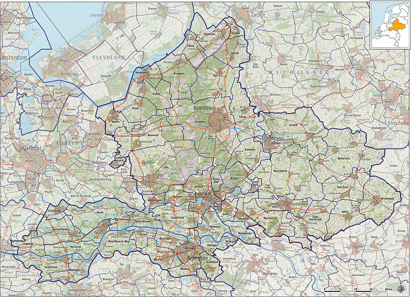 The current province of Gelderland covers about the area of three quarters of the historical Duchy of Guelders. Guelders was a county in the late 11th century and then a duchy in the Holy Roman Empire, including parts of the present-day Dutch province of Limburg and the German district of Kleve (Cleves). Geldern, the original seat of the dukes, today is in Kleve, Germany. In 1543, Gelderland became one of the Seventeen Provinces of the Habsburg Netherlands, though not one of the richer or more densely-populated provinces. During World War II, it saw heavy fighting between Allied Paratroopers, British XXX Corps and the German II SS Panzer Corps, also known as the Battle of Arnhem.
Geography
Gelderland is geographically divided into three regions: the Veluwe in the north, the Betuwe in the southwest and the Achterhoek (literally meaning the "back corner") or Graafschap (which originally means earldom or county) in the east.
Currently (2011), the municipalities in Gelderland are as follows:
Aalten
Apeldoorn
Arnhem
Barneveld
Berkelland
Beuningen
Bronckhorst
Brummen
Buren
Culemborg
Doesburg
Doetinchem
Druten
Duiven
Ede
Elburg
Epe
Ermelo
Geldermalsen
Groesbeek
Harderwijk
Hattem
Heerde
Heumen
Lingewaal
Lingewaard
Lochem
Maasdriel
Millingen aan de Rijn
Montferland
Neder-Betuwe
Neerijnen
Nijkerk
Nijmegen
Nunspeet
Oldebroek
Oost Gelre
Oude IJsselstreek
Overbetuwe
Putten
Renkum
Rheden
Rijnwaarden
Rozendaal
Scherpenzeel
Tiel
Ubbergen
Voorst
Wageningen
West Maas en Waal
Westervoort
Wijchen
Winterswijk
Zaltbommel
Zevenaar
Zutphen
Overijssel
- Details
- Category: 12 provinces
Overijssel is a province[1] of the Netherlands in the central-eastern part of the country. The province's name means "Lands across the river Issel", from the perspective of southern Europe. The capital city of Overijssel is Zwolle and the largest city is Enschede. The province has a population of 1,113,529 inhabitants.
Geography Map of the Archbishopric of Utrecht around 1350, when present-day Overijssel was part of the region Oversticht
Overijssel is bordered by Germany to the east, the Achterhoek region of Gelderland to the south, the Veluwe region of Gelderland and Flevoland to the west, and Friesland and the former moors of Drenthe to the north. Overijssel comprises three regions: Kop van Overijssel in the northwest, Salland in the centre of the province, and Twente in the east. Besides the capital Zwolle, the major cities are Almelo, Deventer, Enschede, and Hengelo.
To the southeast, the province's surface is mostly sandy, interspersed with small rivers such as the Regge and Dinkel and other brooks. In the northwest, the geology is dominated by sediments from the Overijsselse Vecht and clay. The northern parts were once covered by veen (bogs) which separated the dryer and more arable south from Drenthe and which have been exploited as fuel to a large degree. Only small patches survive today (Engbertsdijksvenen near Tubbergen, Witteveen (near Haaksbergen), and the Aamsveen (near Enschede). The extreme northwest is dominated by a system of lakes formed by former peat-mining, the Weerribben, which is a valuable wetland.
The highest point in Overijssel is the summit of the Tankenberg, a hill in the municipality of Losser, at 89 metres (295 ft). The lowest point is in the Mastenbroek Polder near Kampen at 2 metres (6 ft) below sea level.
History
During its early history, Overijssel was formerly known as Oversticht and also included much of modern-day Drenthe. In 1336, it was made part of Guelders, though it was ceded to the Bishopric of Utrecht in 1347 and was known as het Sticht. The Bishops ceded the Oversticht to the Emperor Charles V in 1528, who styled himself Lord of Overijssel, thereby giving the province its modern name. The people joined with the other Dutch and rebelled against Charles' heir Philip II. Overijssel became governed by the most powerful mayors and lords in the province.
After a brief occupation by the forces of the Bishop of Münster (1672–74), Overijssel received a new form of government which granted the stadtholders more power. Widespread resistance against the increased power throughout the provinces eventually led to the formation of the Batavian Republic in 1795. A centralist government arose and the Netherlands was organised into a series of départements, based on those used by revolutionary France. At first organised into its own département, it was merged with Drenthe in 1798 to form Ouden IJssel, which was renamed Overijssel in 1801.
The French annexed the Batavian Republic in 1810, and Overijssel was organised into the new French département of Bouches-de-l'Yssel. After the defeat of Napoleon in 1814, the kingdom of the Netherlands and the former province of Overijssel were recreated. Overijssel was occupied by Nazi Germany during World War II from May 1940 until its liberation in April 1945. The Noordoostpolder, which had been laid dry in 1942, was part of Overijssel from 1962 until 1986, when it became part of the newly created province of Flevoland.
Municipalities
The municipalities of Overijssel
Almelo
Borne
Dalfsen
Dinkelland
Deventer
Enschede
Haaksbergen
Hardenberg
Hellendoorn
Hengelo
Hof van Twente
Kampen
Losser
Oldenzaal
Olst-Wijhe
Ommen
Raalte
Rijssen-Holten
Staphorst
Steenwijkerland
Tubbergen
Twenterand
Wierden
Zwartewaterland
Zwolle
Drenthe
- Details
- Category: 12 provinces
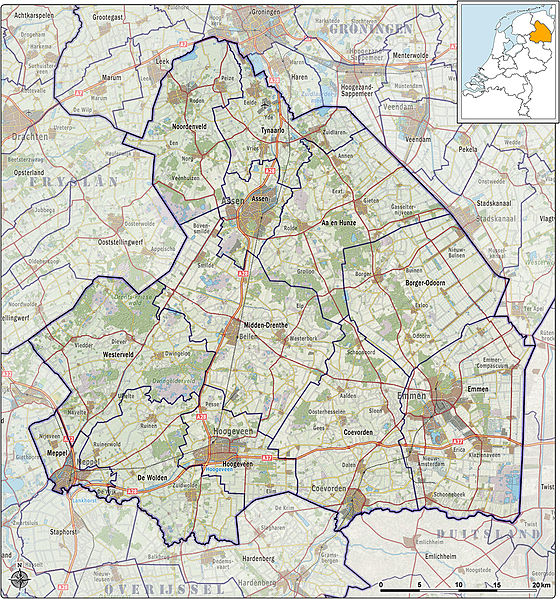
Drenthe is a province of the Netherlands, located in the north-east of the country. The capital city is Assen. It is bordered by Overijssel to the south, Friesland to the west, Groningen to the north, and Germany (districts of Emsland and Bentheim) to the east.
History
Drenthe, unlike many other parts of the Netherlands, has been a sparsely populated rural area since medieval times. Except for some industry in Assen and Emmen, the lands in Drenthe are mainly used for farming.
 Drenthe has been populated by people since prehistory. Artifacts from the Wolstonian Stage (150.000 years ago) are among the oldest found in the Netherlands. In fact, it was one of the most densely populated areas of the Netherlands until the Bronze Age. Most tangible evidence of this are the dolmens (hunebedden) built around 3500 BC, 53 of the 54 dolmens in the Netherlands can be found in Drenthe, concentrated in the northeast of the province.
Drenthe was first mentioned in a document from the year 820, it was called Pago Treanth (district Drenthe). In archives from "Het Utrechts Archief", from 1024 to 1025, the "county Drenthe" is mentioned, when Emperor Henry II gave it to Bishop Adalbold II of Utrecht.
After long being subject to the Utrecht diocese, Bishop Henry of Wittelsbach in 1528 ceded Drenthe to Emperor Charles V of Habsburg, who incorporated it into the Habsburg Netherlands. When the Republic of the Seven United Provinces was declared in 1581, Drenthe became part of it, although it did not gain provincial status until January 1, 1796 due to its poverty.
Shortly before the outbreak of the Second World War, the Dutch government built a camp near the town of Hooghalen to accommodate German (Jewish) refugees. Ironically, during the Second World War, the German occupiers used the camp (which they named KZ Westerbork) as a "Durchgangslager" (transit camp). Many Dutch Jews, Sinti, Roma, resistance combatants and political adversaries were imprisoned before being transferred to concentration and extermination camps in Germany and Poland. Anne Frank was deported on the last train leaving the Westerbork transit camp, on 3 September 1944.
The name of this region is said to stem from *thrija-hantja "three lands".
Municipalities
Due to reorganisations in the 1990s, the number of municipalities in Drenthe has been reduced to twelve. Most municipalities therefore now consist of several towns and villages.
Aa en Hunze
Assen
Borger-Odoorn
Coevorden
De Wolden
Emmen
Hoogeveen
Meppel
Midden-Drenthe
Noordenveld
Tynaarlo
Westerveld
Groningen
- Details
- Category: 12 provinces
Groningen is the northeasternmost province of the Netherlands. In the east it borders the German state of Niedersachsen (districts of Leer and Emsland), in the south Drenthe, in the west Friesland and in the north the Wadden Sea. The capital of the province is the city of Groningen.
Geography
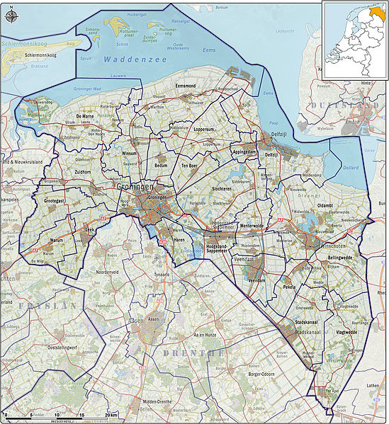 Land use in Groningen is mainly agricultural; it has a large natural gas field near Slochteren. but, Groningen has many historical monuments and many old buildings in almost every village.
History
Originally a part of Frisia, Groningen became a part of the Frankish Empire around 785. Charlemagne assigned the Christianization of this new possession to Ludger. In the 11th century, the city of Groningen was a village in Drenthe that belonged to the Bishopric of Utrecht, while most of the province was in the diocese of Münster. During the Middle Ages, central control was remote, and the city of Groningen acted as a city state, exerting a dominating influence on the surrounding Ommelanden. Around 1500, Maximilian I, Holy Roman Emperor gave Groningen and Friesland to Albert, Duke of Saxony, who could however not establish permanent control. In 1514/15 Groningen came to the Duchy of Guelders, and in 1536 to the Habsburg Netherlands. In 1594, Groningen was conquered by the United Netherlands, to which it belonged henceforth.
Municipalities
Appingedam
Bedum
Bellingwedde
De Marne
Delfzijl
Eemsmond
Groningen
Grootegast
Haren
Hoogezand-Sappemeer
Leek
Loppersum
Marum
Menterwolde
Oldambt
Pekela
Slochteren
Stadskanaal
Ten Boer
Veendam
Vlagtwedde
Winsum
Zuidhorn
Gazetteer for Goningen on Google Maps
Friesland
- Details
- Category: 12 provinces
Friesland or Frisia is a province in the north of the Netherlands and part of the ancient, larger region of Frisia.
Friesland has 646,000 inhabitants (2010) and its capital is Leeuwarden (West Frisian: Ljouwert), with 91,817 inhabitants, in the centre of the province.
Name
In 1996 the Friesland Provincial Council resolved that the official name of the province should follow the Fries spelling rather than the Dutch spelling, resulting in "Friesland" being replaced by "Fryslân".[1] In 2004 the Dutch Government confirmed this resolution, putting in place a three-year scheme to oversee the name change and associated cultural programme.
 The province of Friesland is occasionally referered to as "Frisia" by, amongst others, Hanno Brand, head of the history and literature department at the Fryske Akademy since 2009, however the English-language webpage of the Friesland Provincial Council refers to the province as "Fryslan".
Geography
Friesland is the largest Dutch province if one includes areas of water; in terms of land area only, it is the third largest province. Most of Friesland is on the mainland, but it also includes a number of West Friesian islands, including Vlieland, Terschelling, Ameland and Schiermonnikoog, which are connected to the mainland by ferry. The province's highest point is at 45 metres above sea level, on the island of Vlieland. There are four national parks: Schiermonnikoog, De Alde Feanen, Lauwersmeer (Groningen and Friesland) and Drents-Friese Wold (Drenthe and Friesland).
History
A proto-Frisian culture slowly began to emerge around 400-200 BC. The Roman occupation of Frisia began in 12 BC with the campaign of Nero Claudius Drusus in Germania. The early 8th century AD is known for the Frisian king Redbad and the missionary Saint Boniface.
At the start of the Middle Ages Frisia stretched from what is now the Belgian border to the river Weser in Germany. After incorporation into the Frankish empire, Friesland was divided into three parts. The westernmost part developed at the start of the 2nd millennium into the County of Holland.
Language and economy
Friesland is one of the twelve provinces of the Netherlands to have its own language, West Frisian. This is also spoken in a small adjacent part of the province of Groningen, to the east. Closely related languages are spoken in nearby areas of Germany. They are East Frisian (Seeltersk, which is different from "East Frisian (Ostfriesisch) and is spoken in the Saterland, and a collection of Low German dialects of East Frisia) and North Frisian, spoken in North Friesland. These languages are also closely related to English.
Friesland is mainly an agricultural province. The black and white Frisian cattle and the black Frisian horse originated here. Tourism is another important source of income: the principal tourist destinations include the lakes in the southwest of the province and the islands in the Wadden Sea to the north. There are 195 windmills in the province of Friesland, out of a total of about 1200 in the entire country.
10 largest towns by population
Towns (Frisian name) Population
1 Leeuwarden (Ljouwert) 96,578
2 Drachten 44,598
3 Sneek (Snits) 33,401
4 Heerenveen (It Hearrenfean) 28,497
5 Harlingen (Harns) 15,729
6 Dokkum 13,145
7 Franeker (Frjentsjer) 12,995
8 Joure (De Jouwer) 12,902
9 Wolvega (Wolvegea) 12,738
10 Lemmer (De Lemmer) 10,220
Municipalities
Achtkarspelen
Ameland
Boarnsterhim
Dantumadiel
Dongeradeel
Ferwerderadiel
Franekeradeel
Gaasterlân-Sleat
Harlingen
Heerenveen
Het Bildt
Kollumerland c.a.
Leeuwarden
Leeuwarderadeel
Lemsterland
Littenseradiel
Menaldumadeel
Ooststellingwerf
Opsterland
Schiermonnikoog
Skarsterlân
Smallingerland
Súdwest Fryslân
Terschelling
Tytsjerksteradiel
Vlieland
Weststellingwerf
Utrecht
- Details
- Category: 12 provinces
Utrecht is the smallest province of the Netherlands in terms of area, and is located in the centre of the country. It is bordered by the Eemmeer in the north, Gelderland in the east, the river Rhine in the south, South Holland in the west, and North Holland in the northwest. Utrecht makes up one region of the International Organization for Standardization world region code system, having the code ISO 3166-2:NL-UT. Important cities in the province are its capital (also called Utrecht), Amersfoort, Veenendaal, Houten, Nieuwegein and Zeist.
History
In the Middle Ages, most of the area of the current province was ruled by bishops of the Bishopric of Utrecht. The bishopric was founded in 722 by Willibrord. Many wars were fought between Utrecht and the neighbouring counties and duchies, Holland, Guelders and Brabant. In 1527, the bishop of  Utrecht sold his worldly power over his territories to Emperor Charles V, who already owned most other Dutch provinces. However, the Habsburg rule did not last long, as Utrecht joined the revolt of the United Provinces against Charles's son Philip II of Spain in 1579. In World War II, Utrecht was held by German forces until the general capitulation of the Germans in the Netherlands on May 5, 1945. It was occupied by Canadian Allied forces on May 7, 1945. The towns of Oudewater, Woerden and Vianen were transferred from the province of South Holland to Utrecht in 1970, 1989 and 2002 respectively.
In February 2011, Utrecht, together with the provinces of North Holland and Flevoland, showed a desire to investigate the feasibility of a merger between the three provinces.[1] This has been positively received by the Dutch cabinet, for the desire to create one Randstad province has already been mentioned in the coalition agreement.[2] The province of South Holland, part of the Randstad urban area, visioned to be part of the Randstad province,[3] and very much supportive of the idea of a merger into one province,[4] is not named. With or without South Holland, if created, the new province would be the largest in the Netherlands in both area and population.
Geography
In the east of Utrecht lies the Utrecht Hill Ridge (Dutch: Utrechtse Heuvelrug), a chain of hills left as lateral moraine by tongues of glacial ice after the Saline glaciation that preceded the last ice age. Because of the scarcity of nutrients in the fast-draining sandy soil, the greatest part of a landscape that was formerly heath has been planted with pine plantations. The south of the province is a river landscape. The west consists mostly of meadows. In the north are big lakes formed by the digging of peat from bogs formed after the last ice age.
Municipalities
The Province of Utrecht consists of 26 municipalities.
Amersfoort
Baarn
Bunnik
Bunschoten
De Bilt
De Ronde Venen
Eemnes
Houten
IJsselstein
Leusden
Lopik
Montfoort
Nieuwegein
Oudewater
Renswoude
Rhenen
Soest
Stichtse Vecht
Utrecht
Utrechtse Heuvelrug
Veenendaal
Vianen
Wijk bij Duurstede
Woerden
Woudenberg
Zeist
Flevoland
- Details
- Category: 12 provinces
Flevoland is a province of the Netherlands. Located in the centre of the country, at the location of the former Zuiderzee, the province was established on January 1, 1986; the twelfth province of the country, with Lelystad as its capital. The province has approximately 394,758 inhabitants (2011) and consists of 6 municipalities.
History
After a flood in 1916, it was decided that the Zuiderzee, an inland sea within the Netherlands, would be enclosed and reclaimed: the Zuiderzee Works started. In 1932, the Afsluitdijk was completed, which closed off the sea completely. The Zuiderzee was subsequently called IJsselmeer (lake at the end of the river IJssel).
The first part of the new lake that was reclaimed was the Noordoostpolder (Northeast polder). This new land included the former islands of Urk and Schokland and it was included in the province of Overijssel. After this, other parts were reclaimed: the Southeastern part in 1957 and the Southwestern part in 1968. There was an important change in these post-war projects from the earlier Noordoostpolder reclamation: a narrow body of water was preserved along the old coast to stabilise the water table and to prevent coastal towns from losing their access to the sea. Thus Flevopolder became an artificial island joined to the mainland by bridges. The municipalities on the three parts voted to become a separate province, which happened in 1986.
Flevoland was named after Lacus Flevo, a name recorded in Roman sources for a large inland lake at the southern end of the later-formed Zuiderzee. Draining the Flevoland polders found many wrecks of aircraft that crashed into the IJsselmeer during World War II, and also fossils of Pleistocene mammals.
In February 2011, Flevoland, together with the provinces of Utrecht and North Holland, showed a desire to investigate the feasibility of a merger between the three provinces.[1] This has been positively received by the Dutch cabinet, for the desire to create one Randstad province has already been mentioned in the coalition agreement.[2] The province of South Holland, part of the Randstad urban area, visioned to be part of the Randstad province,[3] and very much supportive of the idea of a merger into one province,[4] is not named. With or without South Holland, if created, the new province would be the largest in the Netherlands in both area and population.
Flevolands, Zuiderzee Works
Eastern Flevoland (Oostelijk Flevoland or Oost-Flevoland) and Southern Flevoland (Zuidelijk Flevoland or Zuid-Flevoland), unlike the Noordoostpolder, have peripheral lakes between them and the mainland: the Veluwemeer and Gooimeer respectively, making them, together, the world's largest artificial island.
They are two separate polders that have a joint hydrological infrastructure, with a dividing dike in the middle, the Knardijk, that will keep one polder safe should the other be flooded. The two main drainage canals that traverse the dike can be closed by weirs in such an event. The pumping stations are the Wortman (diesel powered) at Lelystad-Haven, the Lovink near Harderwijk on the mainland and the Colijn (both electrically powered) along the northern dike beside the Ketelmeer.
A new element in the design of Eastern Flevoland is the larger city Lelystad (1966), named after Cornelis Lely, the man who had played a crucial role in designing and realising the Zuiderzee Works. Other more conventional settlements already existed by then; Dronten, the major local town, was founded in 1962, followed by two smaller satellite villages, Swifterbant and Biddinghuizen, in 1963. These three were incorporated in the new municipality of Dronten on January 1, 1972.
Southern Flevoland has only one pumping station, the diesel powered De Blocq van Kuffeler. Because of the hydrological union of the two Flevolands it simply joins the other three in maintaining the water-level of both polders. Almere relieves the housing shortage and increasing overcrowding on the old land. Its name is derived from the early medieval name for Lacus Flevo. Almere was to be divided into 3 major settlements initially; the first, Almere-Haven (1976) situated along the coast of the Gooimeer (one of the peripheral lakes), the second and largest was to fulfill the role of city centre as Almere-Stad (1980) and the third was Almere-Buiten (1984) to the northwest towards Lelystad. In 2003, the municipality made a new Structuurplan which started development of three new settlements: Overgooi in the southeast, Almere-Hout in the east, and Almere-Poort in the West. In time, Almere-Pampus could be developed in the northwest, with possibly a new bridge over the IJmeer towards Amsterdam.
The Oostvaardersplassen is a landscape of shallow pools, islets and swamps. Originally, this low part of the new polder was destined to become an industrial area. Spontaneous settlement of interesting flora & fauna turned the area into a nature park, of such importance that the new railway-line was diverted. The recent decline in agricultural land use will in time make it possible to expand natural land use, and connect the Oostvaardersplassen to the Veluwe.
The centre of the polder most closely resembles the pre-war polders in that it is almost exclusively agricultural. In contrast, the southeastern part is dominated by extensive forests. Here is also found the only other settlement of the polder, Zeewolde (1984), again a more conventional town acting as the local centre. Zeewolde became a municipality at the same time as Almere on January 1, 1984, which in the case of Zeewolde meant that the municipality existed before the town itself, with only farms in the surrounding land to be governed until the town started to grow.
Municipalities
Almere - far west of southern island
Dronten - far east of southern island
Lelystad - middle of northern edge of southern island
Noordoostpolder - most of north-eastern polder
Urk - small area on west of north-eastern polder
Zeewolde - southern part of southern island
North Holland
- Details
- Category: 12 provinces
North Holland is a province situated on the North Sea in the northwest of the Netherlands. The provincial capital is Haarlem and its largest city is Amsterdam.
 North Holland is a broad peninsula for the most part, located between the North Sea, Markermeer and the IJsselmeer. More than half of the province consists of reclaimed polder land situated below sea level.
North Holland has four municipalities with 100,000 or more inhabitants. They are, in order of size, Amsterdam (in terms of population this is also the largest municipality in the Netherlands), Haarlem, Zaanstad, and Haarlemmermeer. Another seven municipalities have a population between 50,000 and 100,000 inhabitants (i.e. Hilversum, Amstelveen, Purmerend, Hoorn, Velsen, Alkmaar, and Heerhugowaard.) The island of Texel is also part of North Holland.
Before 1795
For most of its history, the modern-day province of North Holland was an integral part of Holland.
From the 9th century to the 16th century, Holland was a county ruled by the counts of Holland. During this period an area known as West Friesland (now part of North Holland) was conquered and integrated into Holland. For centuries afterwards Holland would be officially called "Holland and West Friesland". The people of West Friesland had (and still have) a strong sense of identity as a region within Holland (and later North Holland).
From the 16th century to 1795, Holland was the wealthiest and most important province in the United Provinces in the Dutch Republic. As the richest and most powerful province, Holland dominated the union. During this period a distinction was sometimes made between the "North Quarter" (Noorderkwartier) and the "South Quarter" (Zuiderkwartier), areas that roughly correspond to the two modern provinces.
The emergence of a new province (1795 to 1840)
The province of North Holland as it is today has its origins in the period of French rule from 1795 to 1813. This was a time of bewildering changes to the Dutch system of provinces. In 1795 the old order was swept away and the Batavian Republic was established. In the Constitution enacted on 23 April 1798, the old borders were radically changed. The republic was reorganised into eight departments (département) with roughly equal populations. Holland was split up into five departments named "Texel", "Amstel", "Delf", "Schelde en Maas", and "Rijn". The first three of these lay within the borders of the old Holland; the latter two were made up of parts of different provinces. In 1801 the old borders were restored when the department of Holland was created. This reorganisation had been short-lived, but it gave birth to the concept of breaking up Holland and making it a less powerful province.
In 1807, Holland was reorganised once again. This time the two departments were called "Amstelland" (corresponding to the modern province of North Holland) and "Maasland" (corresponding to the modern province of South Holland). This also did not last long. In 1810, all the Dutch provinces were integrated into the French Empire. Amstelland and Utrecht were amalgamated as the department of "Zuiderzee" (Zuyderzée in French) and Maasland was renamed "Monden van de Maas" (Bouches-de-la-Meuse in French).
After the defeat of the French in 1813, this organisation remained unchanged for a year or so. When the 1814 Constitution was introduced, the country was reorganised as provinces and regions (landschappen). Zuiderzee and Monden van de Maas were reunited as the province of "Holland". One of the ministers on the constitutional committee (van Maanen) suggested that the old name "Holland and West Friesland" be reintroduced to respect the feelings of the people of that region. This proposal was rejected.
However, the division was not totally reversed. When the province of Holland was re-established in 1814, it was given two governors, one for the former department of Amstelland (i.e. the area that is now North Holland) and one for the former department of Maasland (i.e. now South Holland). Even though the province had been reunited, the two areas were still being treated differently in some ways and the idea of dividing Holland remained alive. (During this reorganisation the islands of Vlieland and Terschelling were returned to Holland and parts of "Hollands Brabant" (including "Land of Altena") went to North Brabant. The borders with Utrecht and Gelderland were definitively set in 1820.)
When the constitutional amendments were introduced in 1840, it was decided to split Holland once again, this time into two provinces called "North Holland" and "South Holland". The need for this was not felt in South Holland or in West Friesland (which feared the dominance of Amsterdam). The impetus came largely from Amsterdam, which still resented the 1838 relocation of the court of appeal to The Hague in South Holland.
 1840 to today
After the Haarlemmermeer was drained in 1855 and turned into arable land, it was made part of North Holland. In exchange, South Holland received the greater part of the municipality of Leimuiden in 1864.
In 1942, the islands Vlieland and Terschelling went back to the province of Friesland.
In 1950, the former island Urk was ceded to the province of Overijssel.
In February 2011, North Holland, together with the provinces of Utrecht and Flevoland, showed a desire to investigate the feasibility of a merger between the three provinces.[2] This has been positively received by the Dutch cabinet, for the desire to create one Randstad province has already been mentioned in the coalition agreement.[3] The province of South Holland, part of the Randstad urban area, visioned to be part of the Randstad province,[4] and very much supportive of the idea of a merger into one province, is not named. With or without South Holland, if created, the new province would be the largest in the Netherlands in both area and population.
Regions in North Holland
North Holland has various regions that, for historical or other reasons, have their own identities. Some of these regions are unofficial, ill-defined and sometimes overlapping. Others are official and are part of regional groupings artificially created for various administrative purposes. These regions are not the same as the municipalities.
List of some of these unofficial and official regions in North Holland:
Amstelland (the area around the Amstel) (prov. North Holland)
Beemster (North Holland)
Bollenstreek (the flower areas found in both North Holland and South Holland)
Het Gooi (usually "Het Gooi" or "'t Gooi", North Holland)
Groene Hart (North Holland, South Holland and Utrecht)
Haarlemmermeer (North Holland)
Holland (North Holland and South Holland)
IJmond ("The Mouth of the IJ")
Kennemerland (North Holland)
Purmer (North Holland)
Kop van Noord-Holland
Noorderkwartier ("The North Quarter")
Noordvleugel ("The North Wing")
Randstad (North Holland, South Holland, Utrecht and Flevoland)
Schermer (North Holland)
De Streek (North Holland)
Texel (North Holland)
Utrechtse Heuvelrug (Utrecht and North Holland)
Vechtstreek ("The Vecht Area") (Utrecht and North Holland)
Waterland (now effectively the municipality of Waterland, North Holland)
West-Friesland (North Holland)
Wieringen (North Holland)
Wieringermeer (North Holland)
Wijdewormer (De Wormer, North Holland)
Zaanstreek ("The Zaan Area") (North Holland)
Latest articles
- Accommodatie Eurovisie Songfestival 2020 - Rotterdam
- Vermeer - famous Dutch painter from Delft
- Delft - Oude Kerk - Old Church
- Delft
- Enkhuizen - Havenweg - streetview - Google Maps
- Alkmaar - cheese market - Waagplein - streetview - Google Maps
- Hoorn - city center - Roode Steen - streetview - Google Maps
- Veere - Townhall - streetview - Google Maps
- Middelburg - Townhall - streetview - Google Maps
- Vlissingen - Smallekade - streetview - Google Maps
- Zierikzee- streetview - Google Maps
- Oosterschelde- streetview - Google Maps
- Haringvlietdam - Haringvlietsluis - streetview - Google Maps
- Hollands Diep - streetview - Google Maps
- Moerdijk bridges - streetview - Google Maps
- Harlingen - streetview - Google Maps
- Stavoren - streetview
- Dokkum - streetview
- Giethoorn - streetview
- Claire Morgan The Sound of Silence - Noord Brabants Museum
Visitors for Visitholland
We have 85 guests and no members online